From ChatGPT 7/8/2025.
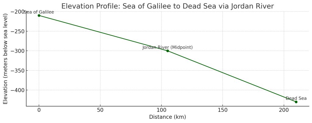
This elevation profile shows the descent from the Sea of Galilee to the Dead Sea along the Jordan River Valley:
- Sea of Galilee: ~-210 m, -688 ft below sea level
- Jordan River (midpoint): ~-300 m
- Dead Sea: ~-430 m, -1,410 ft — the lowest land elevation on Earth
The total elevation drop over the ~210 km stretch is about 220 meters, with a gradual downward slope following the river’s path.
Let me know if you’d like to add more waypoints like Jericho or the baptism site (Bethany beyond the Jordan).

This enhanced elevation profile includes key biblical and historical waypoints along the Jordan Valley route:
- Sea of Galilee (~-210 m, -688 ft)
- Jordan River near Beit She’an (~-260 m)
- Bethany beyond the Jordan (traditional site of Jesus’ baptism) (~-320 m)
- Jericho (~-250 m) – one of the world’s oldest cities
- Dead Sea (~-430 m, 1410 ft) – Earth’s lowest surface point
This profile shows a gentle descent along the river, with elevation dropping more sharply near the Dead Sea basin.
NOTE – 200 KM is approximately 124 miles
