From ChatGPT
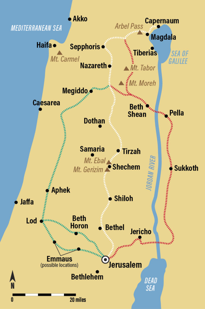
Distance from Megiddo to Nazareth (1st century context)
Modern geographic measurements give a good approximation of the ancient distance, since the two sites have not moved and the basic terrain is the same.
- The distance between Megiddo and Nazareth is about 23–25 kilometers (roughly 14–16 miles), depending on the exact route taken. (fromto.city)
Estimated walking time in the 1st century
Ancient travel on foot typically averaged:
- 2–3 miles per hour on mixed terrain
- 10–20 miles per day depending on terrain, weather, and load
Using the 14–16 mile distance:
- At 2 mph: about 7–8 hours
- At 3 mph: about 5–6 hours
Practical estimate
- Distance: about 15 miles
- Walking time: about 5–7 hours for an average traveler
So Megiddo was essentially a one-day walk from Nazareth under normal conditions in Jesus’s time.
If you want, I can show the likely ancient routes and how the terrain would affect travel time.
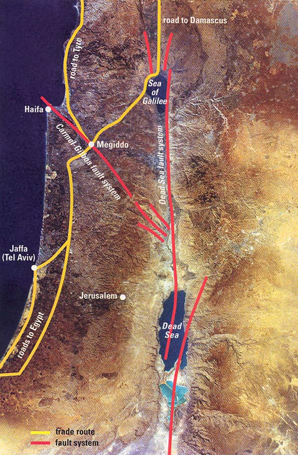
Likely route between Nazareth and Megiddo in the 1st century
In the time of Jesus, travel usually followed natural valleys and established trade routes, not straight lines on a map. The area between Nazareth and Megiddo was already part of a well-known road system.
Geographic context
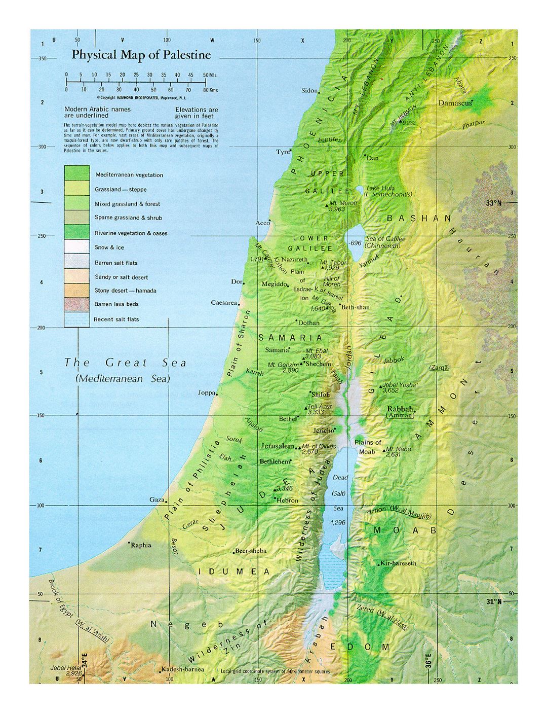
- Nazareth sits in the hills of Lower Galilee.
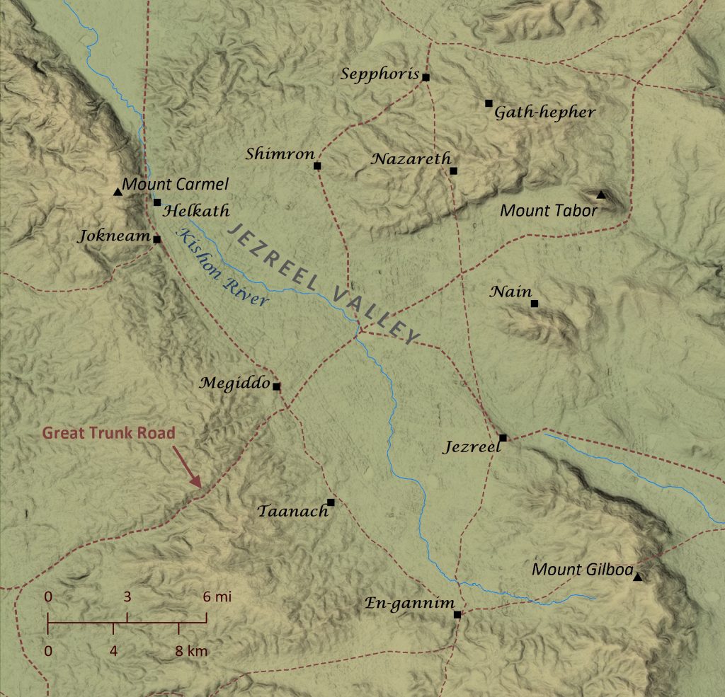
- Megiddo lies at the western edge of the Jezreel Valley, near the strategic pass into the coastal plain.
- The Jezreel Valley was one of the main east-west corridors in ancient Israel.
1) Nazareth to the Jezreel Valley
Travelers leaving Nazareth would first descend from the Galilean hills into the Jezreel Valley.
Distance: about 4–6 miles
Terrain:
- Rolling hills and slopes
- Footpaths and local tracks
- Gradual descent into the valley
Time: about 2–3 hours walking
2) Across the Jezreel Valley toward Megiddo
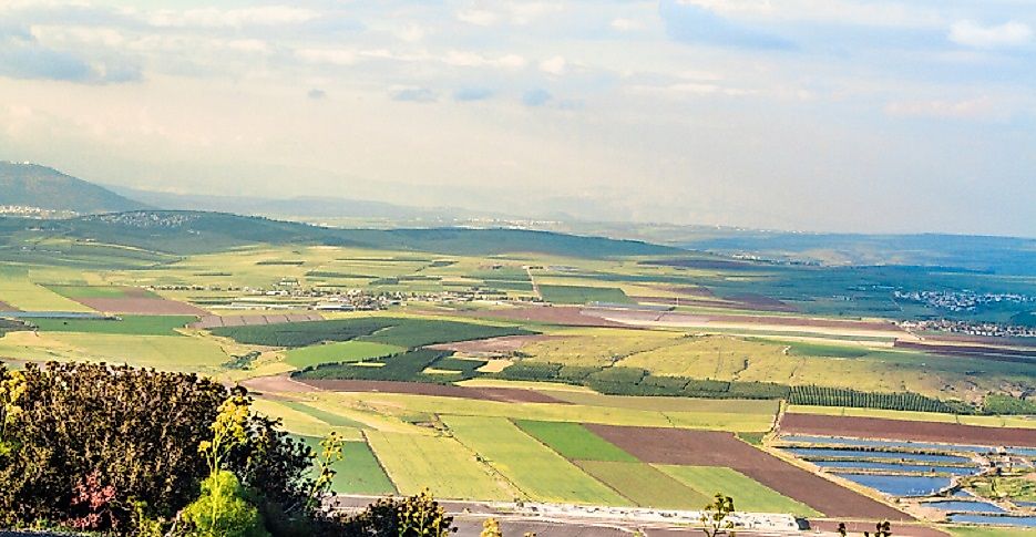

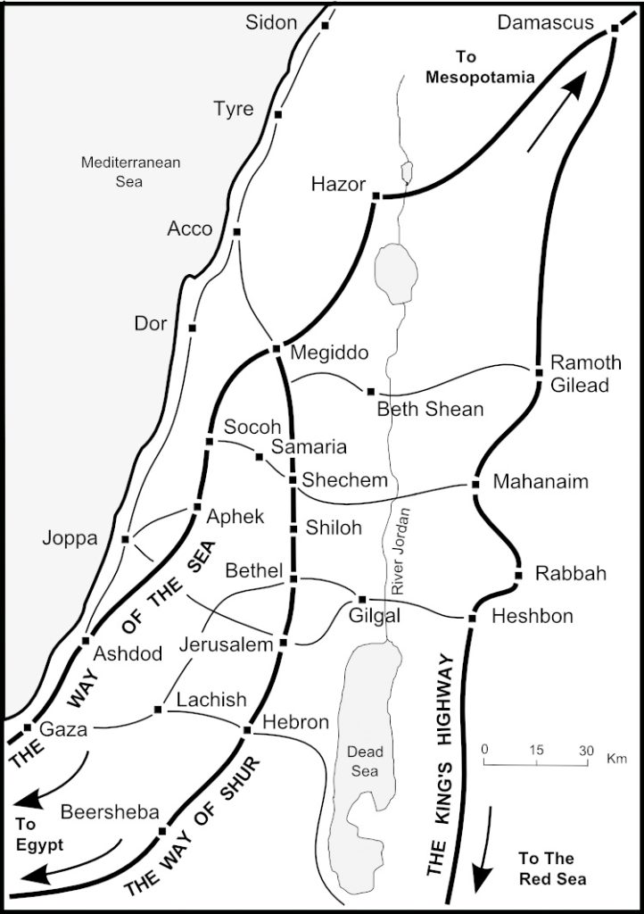
Once in the valley, travelers could join a major east-west trade route, often associated with the Via Maris (“Way of the Sea”), which passed near Megiddo.
Distance: about 9–10 miles
Terrain:
- Flat, open agricultural plain
- Easier walking than the hill country
- Well-traveled roads due to trade and military movement
Time: about 3–4 hours walking
Total journey estimate
| Segment | Miles | Walking time |
|---|---|---|
| Nazareth to valley floor | 4–6 miles | 2–3 hours |
| Valley to Megiddo | 9–10 miles | 3–4 hours |
| Total | 14–16 miles | 5–7 hours |
Nature of the route in Jesus’s time
- The valley corridor was heavily traveled by traders, soldiers, and pilgrims.
- Megiddo controlled the strategic pass between the coastal plain and inland valleys.
- This meant the route would likely be:
- Recognizable
- Frequently used
- Relatively safe compared to remote hill paths
Practical conclusion
A traveler in the 1st century could:
- Leave Nazareth at sunrise
- Walk through the hills into the Jezreel Valley
- Reach Megiddo by early to mid-afternoon
So it was realistically a single-day journey without unusual strain.
Extracts from BiblePlaces.com
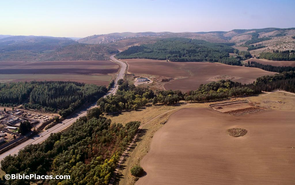
Megiddo Pass
From the earliest times (Early Bronze) to the earliest historical records of the area (Thutmose III) to the future (Revelation 16), Megiddo assumes a prominent role. This is largely owing to its strategic location astride the Megiddo Pass (Wadi Ara) and inside the busy Jezreel Valley. The modern road follows the ancient one; the tel is just off the bottom right corner.
Tunnel to Spring
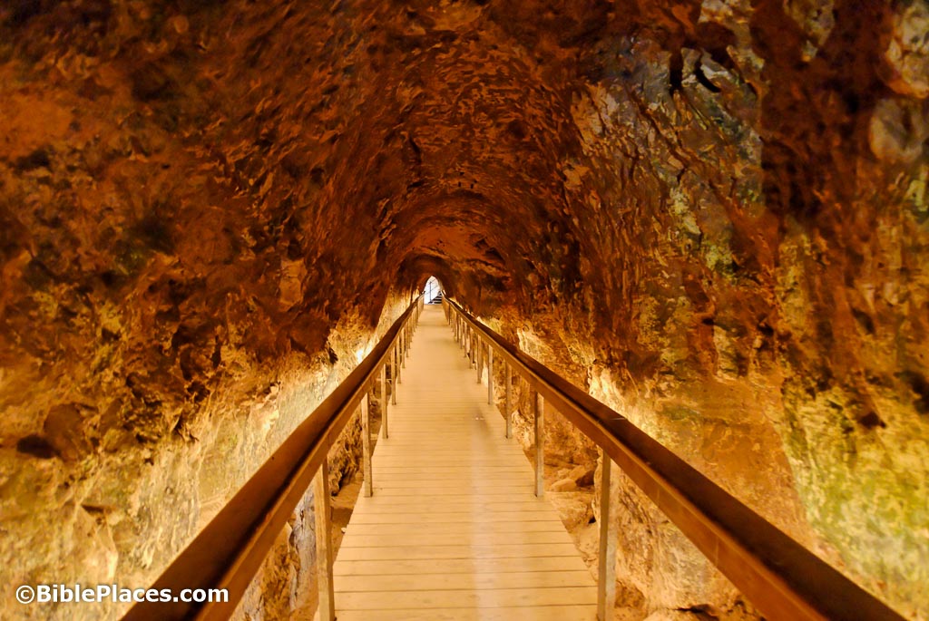
This Iron Age tunnel connected the bottom of Ahab’s shaft to the spring. Before its construction, Megiddo residents had to leave the city walls in order to get water from the spring.
This tunnel was hewn from both ends at the same time (like Hezekiah’s Tunnel) and its builders were only one foot (0.3 m) off when meeting in the middle.